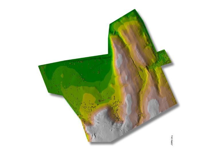
High-resolution DSM for Surface Feature Analysis Digital Surface Models (DSM) capture all surface features—vegetation, buildings, and terrain—with high spatial resolution. These models are essential for urban modeling, vegetation structure analysis, and infrastructure planning. Capture every contour—analyze surface features with precision DSMs.
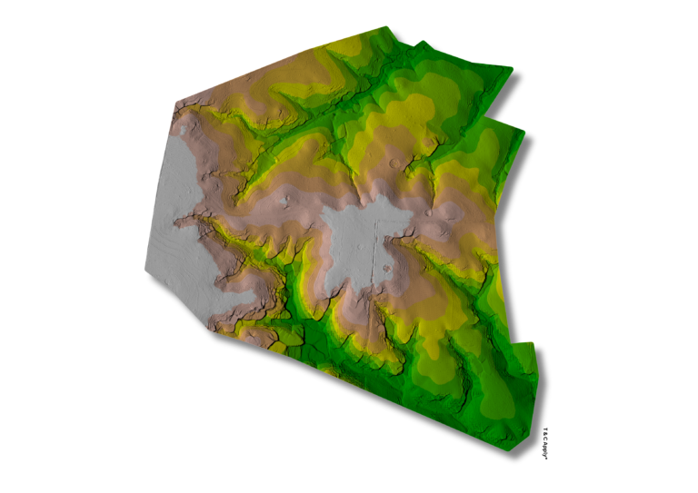
Accurate DTM for Bare-earth Elevation Modeling Digital Terrain Models (DTM) strip away surface features to represent true ground elevation. This supports hydrological modeling, slope analysis, and earthwork estimation with terrain accuracy.
See the ground clearly—model elevation with bare-earth DTMs.
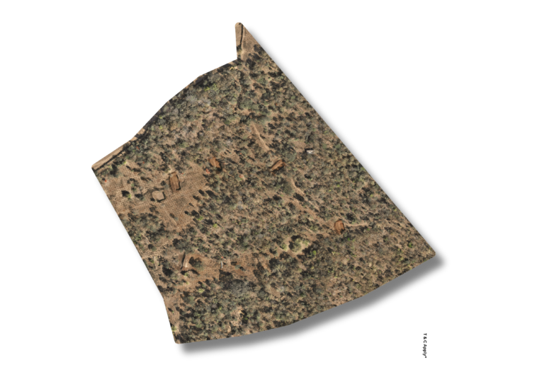
Geo-rectified Orthomosaics for Base Mapping Orthomosaics are stitched, corrected aerial images that provide true-scale, map-accurate visuals. These serve as reliable basemaps for planning, surveying, and land-use analysis.
Map with clarity—use orthomosaics as the foundation for spatial decisions.
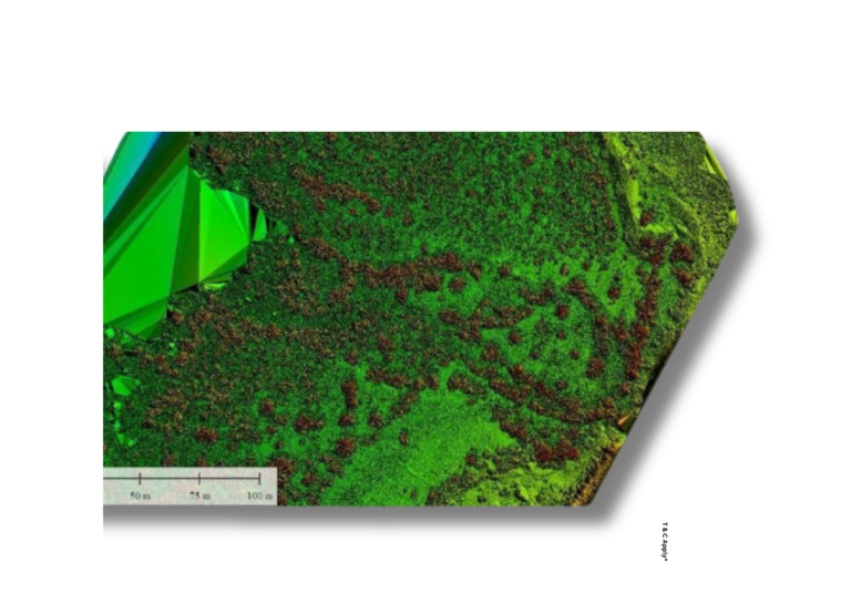
Advanced LiDAR Point Cloud Processing LiDAR point clouds are processed to extract 3D terrain, vegetation, and structural data with centimeter-level accuracy. Applications range from volumetric analysis to topographic mapping and forest metrics.
Elevate your data—turn LiDAR into actionable 3D intelligence.
High-resolution DSM for Surface Feature Analysis Digital Surface Models (DSM) capture all surface features—vegetation, buildings, and terrain—with high spatial resolution. These models are essential for urban modeling, vegetation structure analysis, and infrastructure planning. Capture every contour—analyze surface features with precision DSMs.
Accurate DTM for Bare-earth Elevation Modeling Digital Terrain Models (DTM) strip away surface features to represent true ground elevation. This supports hydrological modeling, slope analysis, and earthwork estimation with terrain accuracy.
See the ground clearly—model elevation with bare-earth DTMs.
Geo-rectified Orthomosaics for Base Mapping Orthomosaics are stitched, corrected aerial images that provide true-scale, map-accurate visuals. These serve as reliable basemaps for planning, surveying, and land-use analysis.
Map with clarity—use orthomosaics as the foundation for spatial decisions.
Advanced LiDAR Point Cloud Processing LiDAR point clouds are processed to extract 3D terrain, vegetation, and structural data with centimeter-level accuracy. Applications range from volumetric analysis to topographic mapping and forest metrics.
Elevate your data—turn LiDAR into actionable 3D intelligence.