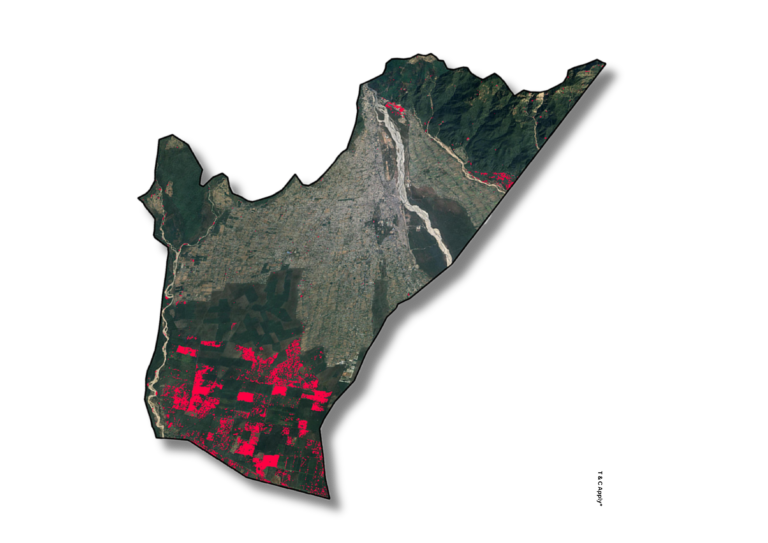
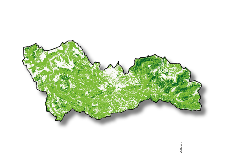
Tree Canopy Cover Tree canopy cover is mapped using high-resolution satellite imagery and remote sensing techniques to quantify forest density, biomass, and carbon storage potential. This is crucial for monitoring deforestation, afforestation, and ecosystem health. Monitor Forest health and carbon dynamics—engage us for precise canopy cover assessments.
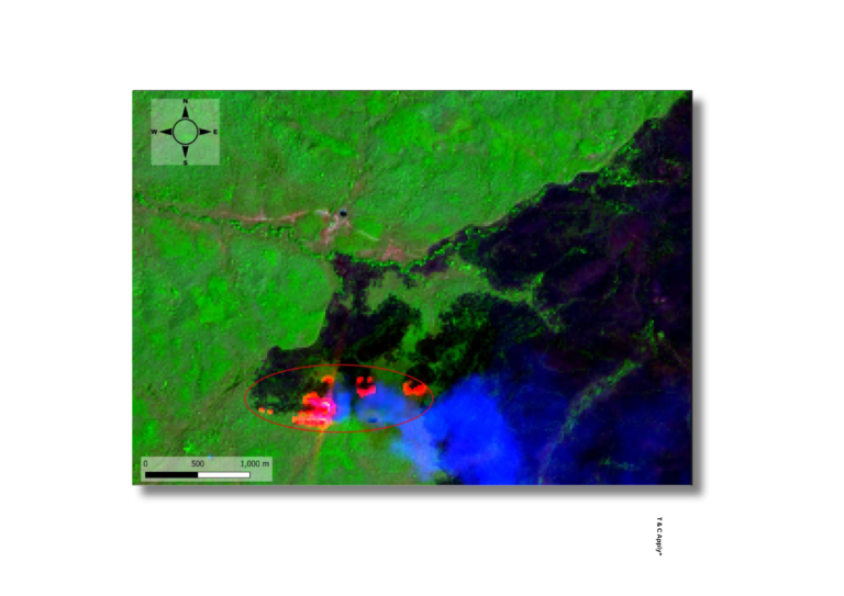
Forest Fire Analysis We provide forest fire analysis using time-series satellite data to detect fire events, map affected areas, and assess temporal patterns. This supports early warning systems and enhances fire risk management strategies. Act early against forest fires—get spatial insights that drive proactive planning
Forest Fire Burn Severity Burn severity mapping evaluates the intensity and ecological impact of forest fires by analyzing pre- and post-fire vegetation conditions. These maps help in understanding recovery patterns and prioritizing restoration efforts. Assess damage and plan recovery with detailed burn severity maps tailored to your region.
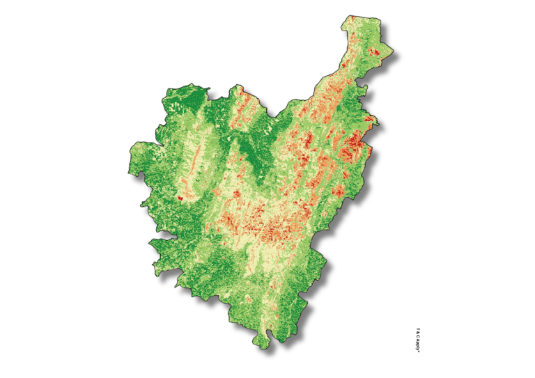
Fragmentation Mapping Fragmentation mapping analyses the spatial breakup of forested areas due to human activity or natural processes. These insights help measure habitat connectivity, guide conservation corridors, and inform sustainable land-use planning. Combat habitat loss—use our fragmentation data to preserve ecological integrity.
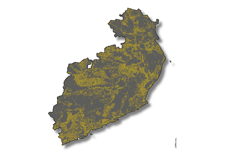
Forest Type Mapping Forest type mapping classifies forest areas based on vegetation composition and structure using satellite data and field inputs. It supports biodiversity assessments, resource inventories, and forest management policies. Understand your forests better—contact us for accurate, science-based forest classification.
Tree Canopy Cover Tree canopy cover is mapped using high-resolution satellite imagery and remote sensing techniques to quantify forest density, biomass, and carbon storage potential. This is crucial for monitoring deforestation, afforestation, and ecosystem health. Monitor Forest health and carbon dynamics—engage us for precise canopy cover assessments.
Forest Fire Analysis We provide forest fire analysis using time-series satellite data to detect fire events, map affected areas, and assess temporal patterns. This supports early warning systems and enhances fire risk management strategies. Act early against forest fires—get spatial insights that drive proactive planning
Forest Fire Burn Severity Burn severity mapping evaluates the intensity and ecological impact of forest fires by analyzing pre- and post-fire vegetation conditions. These maps help in understanding recovery patterns and prioritizing restoration efforts. Assess damage and plan recovery with detailed burn severity maps tailored to your region.
Fragmentation Mapping Fragmentation mapping analyses the spatial breakup of forested areas due to human activity or natural processes. These insights help measure habitat connectivity, guide conservation corridors, and inform sustainable land-use planning. Combat habitat loss—use our fragmentation data to preserve ecological integrity.
Forest Type Mapping Forest type mapping classifies forest areas based on vegetation composition and structure using satellite data and field inputs. It supports biodiversity assessments, resource inventories, and forest management policies. Understand your forests better—contact us for accurate, science-based forest classification.