Watershed boundaries are delineated using high-resolution Digital Elevation Models (DEMs), enabling accurate identification of drainage basins and sub-watersheds. This process is essential for catchment-based planning, soil conservation, and integrated water resource management.
Define flow at the source—delineate watersheds for smarter water planning.
Morphometry Analysis
Watershed boundaries are delineated using high-resolution Digital Elevation Models (DEMs), enabling accurate identification of drainage basins and sub-watersheds. This process is essential for catchment-based planning, soil conservation, and integrated water resource management.
Quantify your terrain—analyze morphometry to predict hydrological response.
Flood-prone areas are identified through elevation modeling, historical rainfall and discharge data, and hydrodynamic simulations. These maps guide zoning regulations, infrastructure design, and disaster preparedness by visualizing areas most at risk under various flood scenarios.
Plan ahead of the flood—map risk zones and safeguard infrastructure.
Flood Risk Mapping
Flood-prone areas are identified through elevation modeling, historical rainfall and discharge data, and hydrodynamic simulations. These maps guide zoning regulations, infrastructure design, and disaster preparedness by visualizing areas most at risk under various flood scenarios.
Plan ahead of the flood—map risk zones and safeguard infrastructure.
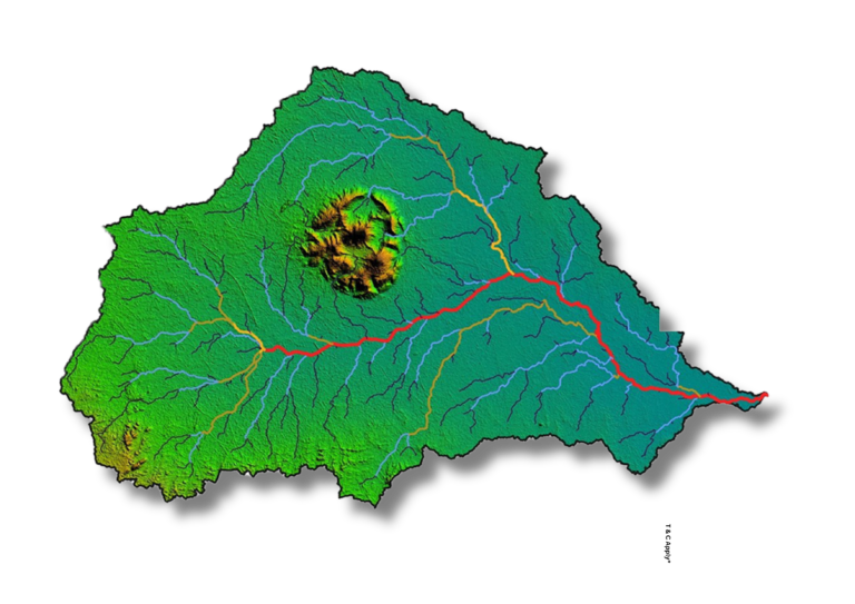
Watershed Delineation
Watershed boundaries are delineated using high-resolution Digital Elevation Models (DEMs), enabling accurate identification of drainage basins and sub-watersheds. This process is essential for catchment-based planning, soil conservation, and integrated water resource management.
Define flow at the source—delineate watersheds for smarter water planning.
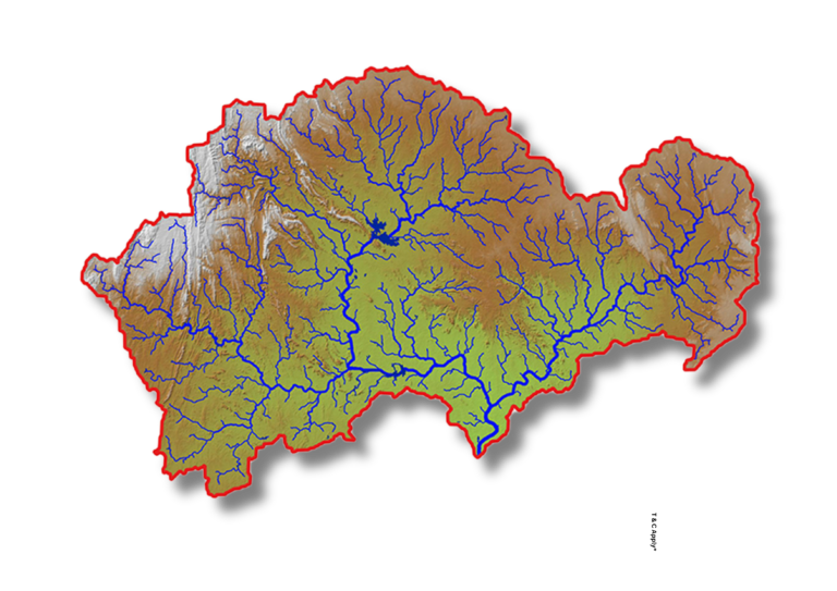
Morphometry Analysis
Watershed boundaries are delineated using high-resolution Digital Elevation Models (DEMs), enabling accurate identification of drainage basins and sub-watersheds. This process is essential for catchment-based planning, soil conservation, and integrated water resource management.
Quantify your terrain—analyze morphometry to predict hydrological response.
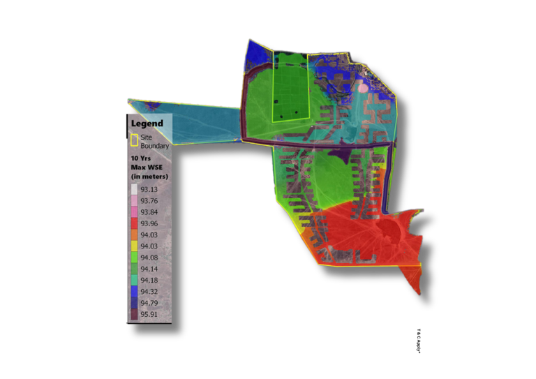
Flood Risk Mapping
Flood-prone areas are identified through elevation modeling, historical rainfall and discharge data, and hydrodynamic simulations. These maps guide zoning regulations, infrastructure design, and disaster preparedness by visualizing areas most at risk under various flood scenarios.
Plan ahead of the flood—map risk zones and safeguard infrastructure.
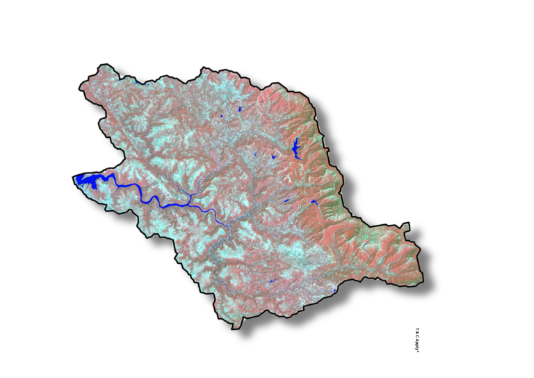
Surface Water Mapping
Surface water bodies—such as rivers, lakes, wetlands, and seasonal streams—are mapped using satellite imagery, drone data, and ground verification. This mapping supports water resource inventories, wetland monitoring, and land-use planning with up-to-date spatial information.
Track every drop—map surface water for effective resource management.