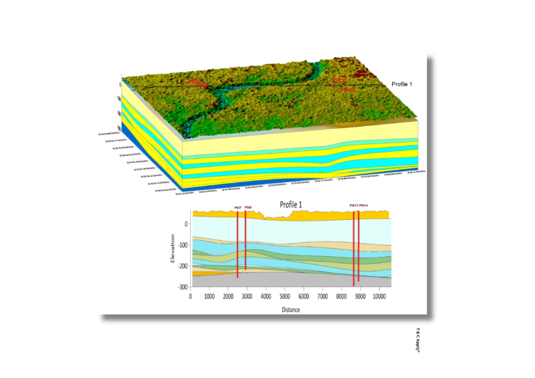
We map hydrogeological zones alongside well penetration data to visualize where aquifers are accessed and how groundwater is distributed. This helps identify productive zones, usage intensity, and informs sustainable well placement and planning.
Map aquifer access with precision—optimize groundwater use and planning.
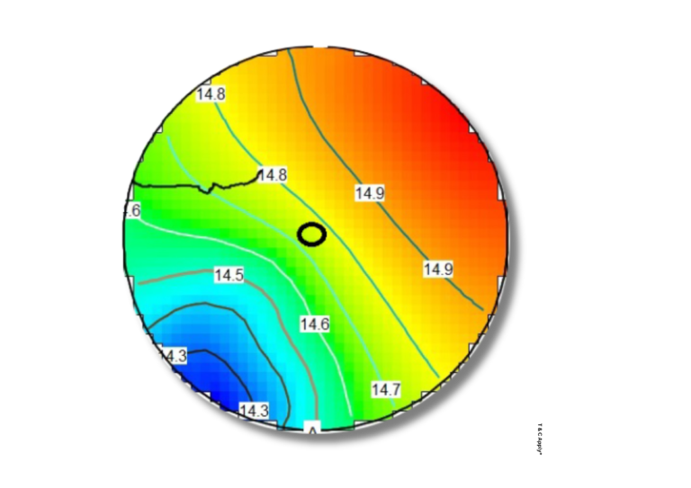
Aquifer Depth & Thickness Mapping By combining well depth data and geological inputs, we create maps showing the vertical and lateral extent of aquifers. These outputs support assessment of groundwater availability, extraction feasibility, and recharge potential.
Understand your aquifer system—map depth and thickness for smarter resource management.
Regional Flow Mapping Regional flow maps illustrate groundwater movement across landscapes, highlighting natural processes like recharge, discharge, and percolation. These visualizations aid in understanding aquifer dynamics and planning water conservation efforts. Visualize groundwater behavior at scale—let us guide your regional water strategy.
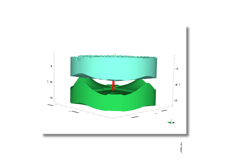
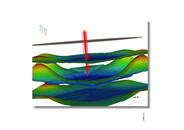
3D Aquifer and Geological Modelling Our 3D models provide in-depth visualization of subsurface geological structures and aquifers, supporting better interpretation of stratigraphy, storage zones, and hydrogeological boundaries. Explore below the surface—engage with us for comprehensive 3D groundwater and geology insights.
Hydrogeological Zoning & Well Penetration We map hydrogeological zones alongside well penetration data to visualize where aquifers are accessed and how groundwater is distributed. This helps identify productive zones, usage intensity, and informs sustainable well placement and planning. Map aquifer access with precision—optimize groundwater use and planning.
Aquifer Depth & Thickness Mapping By combining well depth data and geological inputs, we create maps showing the vertical and lateral extent of aquifers. These outputs support assessment of groundwater availability, extraction feasibility, and recharge potential.
Understand your aquifer system—map depth and thickness for smarter resource management.
Regional Flow Mapping Regional flow maps illustrate groundwater movement across landscapes, highlighting natural processes like recharge, discharge, and percolation. These visualizations aid in understanding aquifer dynamics and planning water conservation efforts. Visualize groundwater behavior at scale—let us guide your regional water strategy.
3D Aquifer and Geological Modelling Our 3D models provide in-depth visualization of subsurface geological structures and aquifers, supporting better interpretation of stratigraphy, storage zones, and hydrogeological boundaries. Explore below the surface—engage with us for comprehensive 3D groundwater and geology insights.