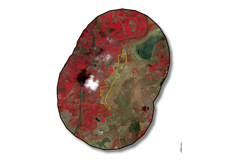
Mine Lease Area Mapping Precise mapping of mine lease boundaries using high-resolution drone imagery, satellite data, and cadastral overlays ensures regulatory compliance and accurate spatial documentation. This process enables clear demarcation of operational zones, buffer areas, and environmental exclusions, supporting legal, environmental, and operational transparency.
Define boundaries with confidence—map mine lease areas with precision and clarity.
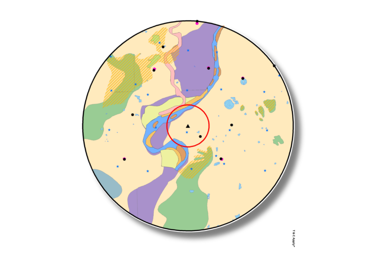
Geological and Geomorphological Mapping Detailed geological and geomorphological mapping involves the interpretation of lithology, structural features, and surface formations using field surveys, drone imagery, and remote sensing data. These maps inform exploration, risk assessment, and environmental planning by identifying fault zones, rock types, landforms, and surface stability conditions.
Unlock the ground’s story—map geology and landforms for smarter exploration.
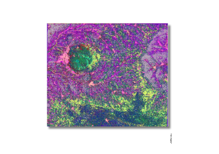
Mineral Identification Mineral identification is carried out using multispectral drone sensors, satellite data, and geochemical ground truthing to detect surface mineral signatures and alteration zones. This supports early-stage exploration, resource targeting, and feasibility assessments by pinpointing zones with economic potential.
Discover value beneath the surface—map and identify mineral zones with precision.
Mine Lease Area Mapping Precise mapping of mine lease boundaries using high-resolution drone imagery, satellite data, and cadastral overlays ensures regulatory compliance and accurate spatial documentation. This process enables clear demarcation of operational zones, buffer areas, and environmental exclusions, supporting legal, environmental, and operational transparency.
Define boundaries with confidence—map mine lease areas with precision and clarity.
Geological and Geomorphological Mapping Detailed geological and geomorphological mapping involves the interpretation of lithology, structural features, and surface formations using field surveys, drone imagery, and remote sensing data. These maps inform exploration, risk assessment, and environmental planning by identifying fault zones, rock types, landforms, and surface stability conditions.
Unlock the ground’s story—map geology and landforms for smarter exploration.
Mineral Identification Mineral identification is carried out using multispectral drone sensors, satellite data, and geochemical ground truthing to detect surface mineral signatures and alteration zones. This supports early-stage exploration, resource targeting, and feasibility assessments by pinpointing zones with economic potential.
Discover value beneath the surface—map and identify mineral zones with precision.