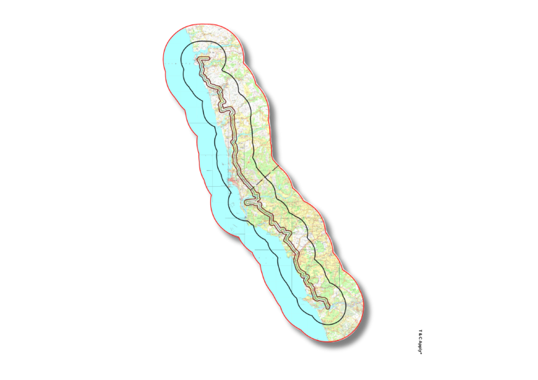
Site Suitability Analysis We assess terrain, land use, slope, soil, and accessibility to identify the most viable locations for construction. Site suitability mapping ensures informed land selection for buildings, infrastructure, and utilities, minimizing risk and cost.
Build on solid ground—choose your site with spatial confidence.
Topographic Mapping High-resolution topographic maps generated from drone and elevation data provide critical insights into terrain contours, elevation changes, and grading requirements—essential for design, excavation, and structural planning.
Plan with precision—map your project’s topography for smarter design.
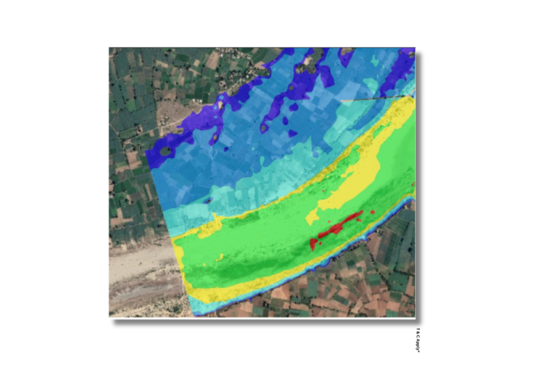
Solar Potential Analysis We conduct detailed analyses including flood modeling, slope evaluation, and terrain characteristics to identify suitable sites for solar energy installations. This integrated approach ensures panels are placed in areas with optimal exposure, structural safety, and minimal environmental risk.
Harness the sun smartly—map solar potential for efficient energy planning.
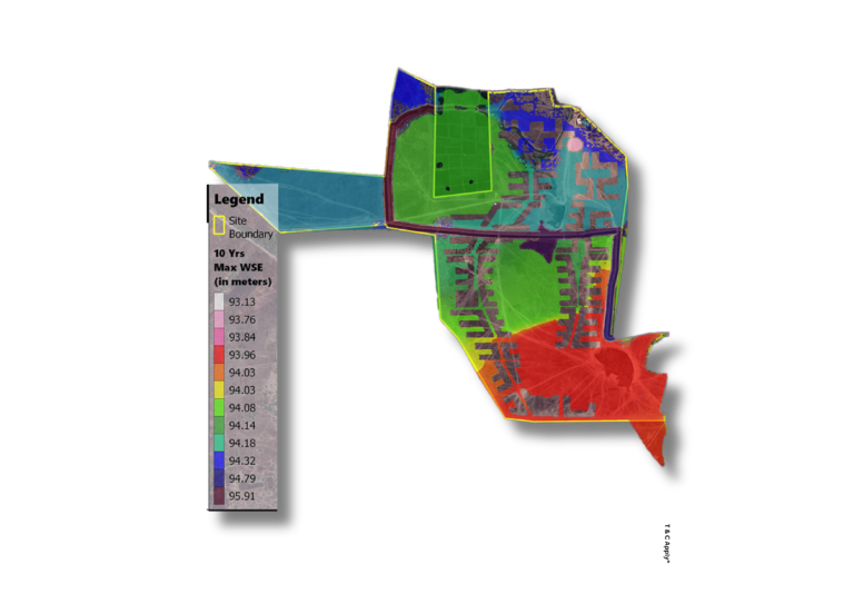
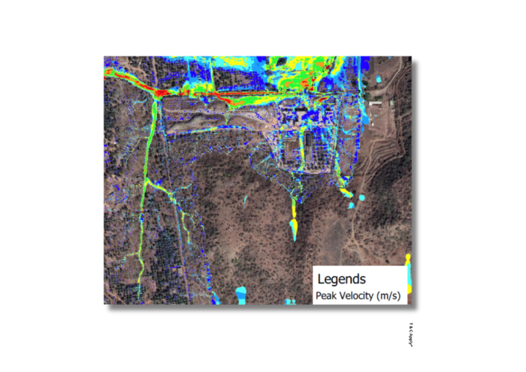
Drainage & Stormwater Flow Modeling We model surface water flow using terrain data to design effective stormwater management systems. These maps help prevent waterlogging, erosion, and structural damage in built environments.
Control the flow—design infrastructure with stormwater in mind.
Site Suitability Analysis We assess terrain, land use, slope, soil, and accessibility to identify the most viable locations for construction. Site suitability mapping ensures informed land selection for buildings, infrastructure, and utilities, minimizing risk and cost.
Build on solid ground—choose your site with spatial confidence.
Topographic Mapping High-resolution topographic maps generated from drone and elevation data provide critical insights into terrain contours, elevation changes, and grading requirements—essential for design, excavation, and structural planning.
Plan with precision—map your project’s topography for smarter design.
Solar Potential Analysis We conduct detailed analyses including flood modeling, slope evaluation, and terrain characteristics to identify suitable sites for solar energy installations. This integrated approach ensures panels are placed in areas with optimal exposure, structural safety, and minimal environmental risk.
Harness the sun smartly—map solar potential for efficient energy planning.
Drainage & Stormwater Flow Modeling We model surface water flow using terrain data to design effective stormwater management systems. These maps help prevent waterlogging, erosion, and structural damage in built environments.
Control the flow—design infrastructure with stormwater in mind.