We assess aboveground and belowground carbon stocks using field data, vegetation indices, and biomass estimation models. This supports climate reporting, ecosystem valuation, and carbon offset project planning across forested and non-forested landscapes.
Quantify nature’s carbon bank—partner with us for accurate carbon stock mapping.
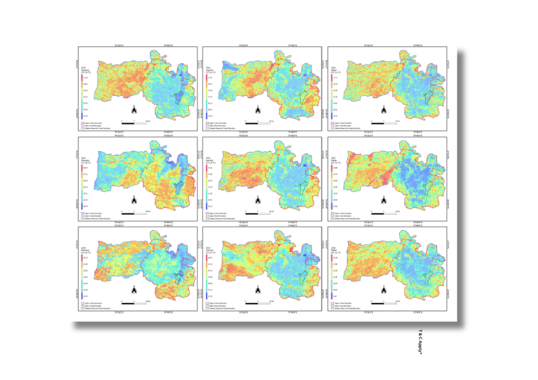
Urban Heat Island Analysis
Urban Heat Islands (UHI) are mapped using thermal remote sensing and land surface temperature data to identify high-heat zones in dense urban environments. This analysis informs urban greening, zoning strategies, and climate-adaptive infrastructure planning.
Cool your city—map and mitigate urban heat islands for resilient design.
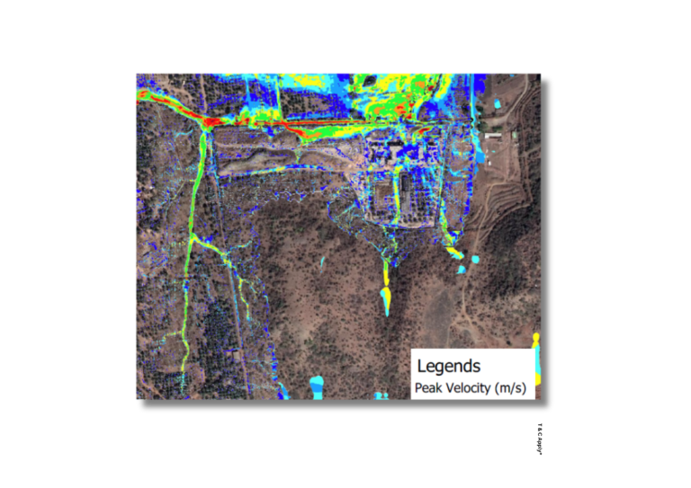
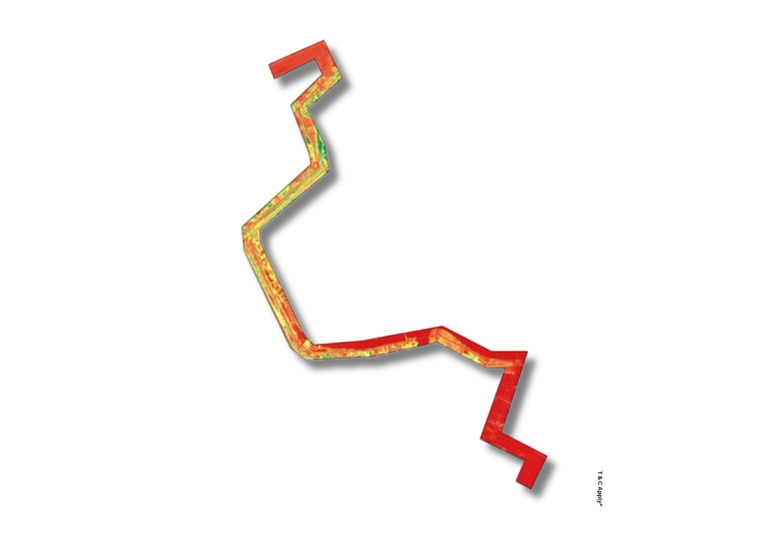
Sea-Level Rise Modeling
We simulate coastal and inland flood risks under various climate change scenarios using elevation models, rainfall data, and sea-level rise projections. These insights support disaster risk reduction and long-term resilience planning.
Anticipate the future—model flood risks and rising seas for climate-safe planning.
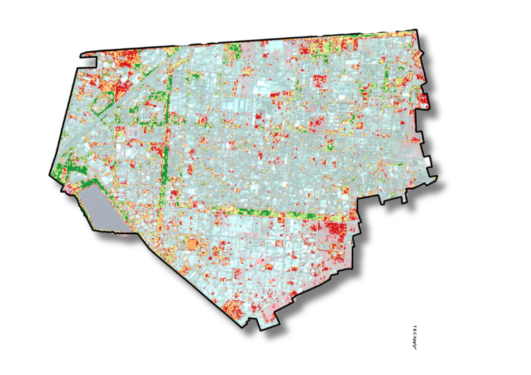
Greenbelt Assessment
We evaluate the extent, continuity, and ecological effectiveness of greenbelts using NDVI, land use classification, and buffer analysis. This helps urban planners optimize green infrastructure for carbon sequestration, heat reduction, and ecosystem health.
Strengthen your green buffer—assess and optimize greenbelts for urban resilience.
Carbon Stock Estimation
We assess aboveground and belowground carbon stocks using field data, vegetation indices, and biomass estimation models. This supports climate reporting, ecosystem valuation, and carbon offset project planning across forested and non-forested landscapes.
Quantify nature’s carbon bank—partner with us for accurate carbon stock mapping.
Urban Heat Island Analysis
Urban Heat Islands (UHI) are mapped using thermal remote sensing and land surface temperature data to identify high-heat zones in dense urban environments. This analysis informs urban greening, zoning strategies, and climate-adaptive infrastructure planning.
Cool your city—map and mitigate urban heat islands for resilient design.
Sea-Level Rise Modeling
We simulate coastal and inland flood risks under various climate change scenarios using elevation models, rainfall data, and sea-level rise projections. These insights support disaster risk reduction and long-term resilience planning.
Anticipate the future—model flood risks and rising seas for climate-safe planning.
Greenbelt Assessment
We evaluate the extent, continuity, and ecological effectiveness of greenbelts using NDVI, land use classification, and buffer analysis. This helps urban planners optimize green infrastructure for carbon sequestration, heat reduction, and ecosystem health.
Strengthen your green buffer—assess and optimize greenbelts for urban resilience.