Building footprints are extracted from high-resolution satellite or drone imagery using automated and semi-automated techniques. This enables accurate urban structure mapping, density analysis, and infrastructure planning.
Map the built environment—extract footprints to plan smarter cities.
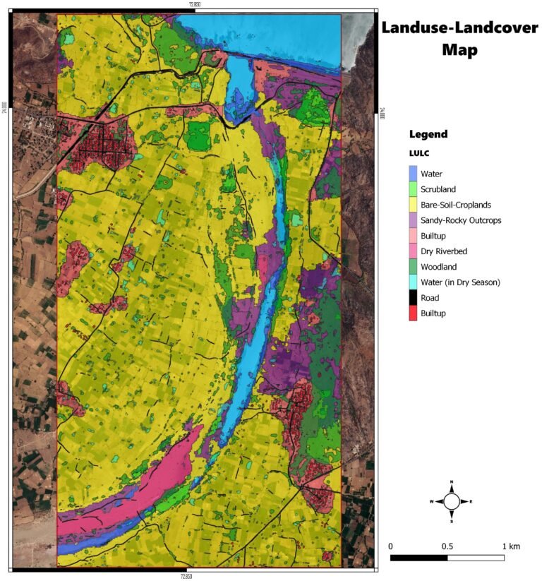
High Resolution Landuse Mapping
Detailed land use classifications—residential, commercial, green space, transport, and more—are mapped using high-resolution imagery and spatial analysis. These maps support zoning, policy-making, and sustainable urban design.
See your city clearly—map land use in detail to shape development.
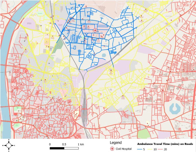
Routing and Location-Allocation Analysis
Spatial analysis tools are used to optimize routes and locate services (schools, hospitals, utilities) based on population, travel time, and demand. This ensures efficient infrastructure placement and equitable service access.
Plan with precision—optimize routes and service locations for better urban access.
Building Extraction
Building footprints are extracted from high-resolution satellite or drone imagery using automated and semi-automated techniques. This enables accurate urban structure mapping, density analysis, and infrastructure planning.
Map the built environment—extract footprints to plan smarter cities.
High Resolution Landuse Mapping
Detailed land use classifications—residential, commercial, green space, transport, and more—are mapped using high-resolution imagery and spatial analysis. These maps support zoning, policy-making, and sustainable urban design.
See your city clearly—map land use in detail to shape development.
Routing and Location-Allocation Analysis
Spatial analysis tools are used to optimize routes and locate services (schools, hospitals, utilities) based on population, travel time, and demand. This ensures efficient infrastructure placement and equitable service access.
Plan with precision—optimize routes and service locations for better urban access.